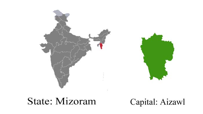
Mizoram – Land Of The Hill People
Mizoram is a treasure – a potpourri of natural beauty, with its emerald valleys, gurgling streams, amazing fields of blooms, and a teeming fauna population. The third youngest state of the Indian Union, Mizoram is perched on the high hills of the northeastern corner of India.
Mizoram has international boundaries with Myanmar and Bangladesh while it shares its domestic borders with the states of Assam, Manipur, and Tripura. Mizoram’s highest peak ‘The Blue Mountain’ rises to a height of 2165 meters. Mizos, the people of Mizoram, are primarily, cultivators. The word Mizo means highlander, a collective name given by their neighbors to a number of tribes that settled in the region. They are originally believed to have come from North-Western China around three centuries ago. Almost all festivals of Mizoram are connected with agricultural activities. Mizoram has a high literacy rate of 87 %, surpassed only by the state of Kerala. Most of the Mizos are Christians and speak Mizo and English.
Fast Facts :
-
Area: 21,087 Sq. Km
-
Capital: Lushai & Aizawl
-
Languages: Mizo and English
-
Religion: Hinduism, Islam, and Christianity
-
Literacy rate: 88.49 %
-
Best Time To Visit: September and October
-
State Emblem: Uses the National Emblem of India

-
State Animal: Himalayan serow (Capricornis thar)
-
State Bird: Mrs. Hume’s pheasant (Syrmaticus humiae)
-
State Tree: Indian rose chestnut (Mesua ferrea)
-
State Flower: Red Vanda (Renanthera imschootiana)
- Culture and Tradition of Mizoram
Tourist Attractions :
Aizawl
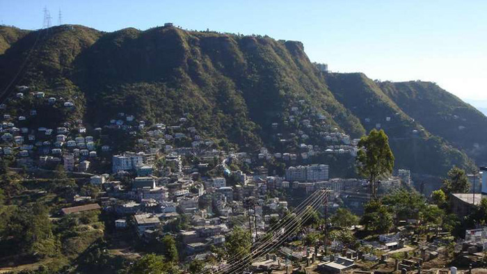
The capital is perched at an altitude of 4000 ft. above sea level. It is accessible from Shillong, Guwahati, and Silchar by bus, road, and car. It stands on a high ridge, fringed on the east by the sylvan valley of the river Tlawng and on the north bounded by the craggy hills of Durtlang.
The Cultural Sub-Centre
This cultural center has been set up on a beautiful hill range, to the north of Aizawl, with the most modern recreational facilities.
State Museum
The State Museum at Macdonald’s Hill houses historical relics, ancient costumes, and traditional implements.
Tamdil
85 km from Aizawl, near Saituai village, is the wonderful lake of Tamdil, an ideal picnic – spot. The lake boasts fine boating facilities.
Vantawng Falls
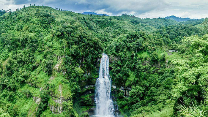
137 km from Aizawl and 5 km from the town of Thenzawl are the largest and most magnificent falls in Mizoram, the Vantawng Falls. The waterfall is 750 feet high and is surrounded by a lush forest teeming with bamboo groves.
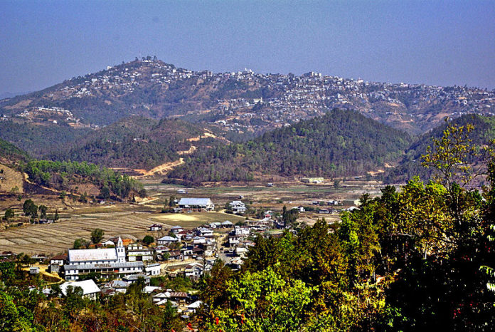
Champhai
8204 km from Aizawl, at the other end of Mizoram, is Champhai, the subdivisional headquarters, which affords a fantastic view of the Myanmar hills.
Phawngpui
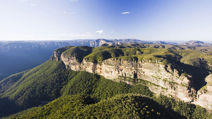
Known as the ‘Blue Mountain‘, Phawngpui is the highest peak in Mizoram. With splendid trees and flowers of all hues, Phawngpui presents a fairytale view of the blue-hazed hills.
Getting There :
- By Air: There is a daily Vayudoot air service between Calcutta and Aizawl.
- By Rail: Silchar, at a distance of 180 km from Aizawl the closest rail station.
- By Road: Buses run by the Mizoram State Transport ply regularly between Silchar and Aizawl.
Suggested Read: Formation Dates of Indian States