Meghalaya -The Abode Of Clouds
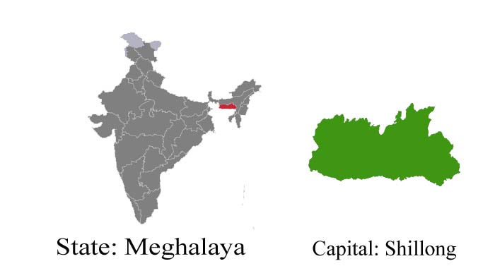
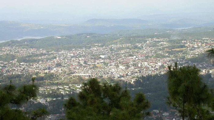
Meghalaya is one of the country’s newest states with its capital at Shillong. For long a summer retreat of the British, the beautifully kept golf course and several English country cottages testify to another influence besides the local one. Beautiful lakes and falls, hillside cottages, a large university, and the popular Bara Bazar are quaint aspects of this town.
The state of Meghalaya is known as the “Meghalaya Plateau” or the “Shillong Plateau“. The area is made up of the oldest rock formations and consists of the Garo, Khasi, and Jaintia hills. Meghalaya is a region of great scenic beauty; a panorama of lush, undulating hills, fertile valleys, 250 species of orchids, meandering rivers, waterfalls, sparkling mountain streams, and lakes. Meghalaya is known for its natural beauty and the simple lifestyle of its tribal people. Meghalaya also receives limelight on account of Cherrapunjee, the wettest place on earth, which is only 56 km away from Shillong.
Fast Facts :
-
Area: 22,429 Sq. Km
-
Capital: Shillong
-
Languages: Khasi, Garo, and English
-
Religion: Hinduism, Islam, and Christianity
-
Literacy rate: 63.31%
-
Best Time To Visit: October to April
-
State Emblem: Uses the National Emblem of India
-
State Animal: Clouded leopard (Neofelis nebulosa)
-
State Bird: Hill myna (Gracula religiosa)
-
State Tree: Gamhar (Gmelina arborea)
-
State Flower: Lady’s Slipper Orchid (Paphiopedilum insigne)
Tourist Attractions :
Shillong
The capital and also a popular hill station. It has a famous 18-hole golf course and a polo ground. Lakes and waterfalls are other attractions of this town. Ward’s Lake, east of Police Bazar is an attractive place with facilities for boating.
Shillong Peak
An ideal picnic spot, 1965 meters above sea level and 10 km from the city, offers a panoramic view of the countryside and is also the highest point in the State. Obeisance is paid to U Shulong at the sanctum at the peak’s summit every springtime, by the religious priest of Mylliem State. In the evening the city lights below appear like a star-studded abyss.
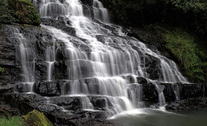
Elephant Falls
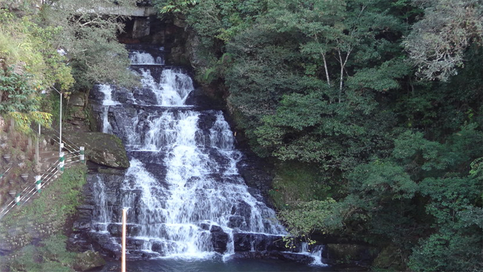
12 km outside of the city the mountain stream descends through two successive falls set in dells of fern-covered rocks.
Bishop & Beadon Falls
Both cascade down the same escarpment into a deep valley, the mass of water dissolving into misty sparks.
Umiam Lake
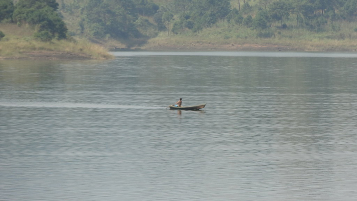
Umiam Khwan (Barapani), offers water sports facilities including sailing, water skiing, and water scooter. Nehru Park is an ideal quiet holiday resort.
Getting There :
- By Air: Nearest airport Borjhar, Guwahati, 129 km from Shillong, is connected with Calcutta. Umroi Airport, 31 km from Shillong, is also connected by Vayudoot with Calcutta.
- By Rail: Nearest Railhead is Guwahati.
- By Road: Day and night bus services are available from Shillong to all major towns of Meghalaya.